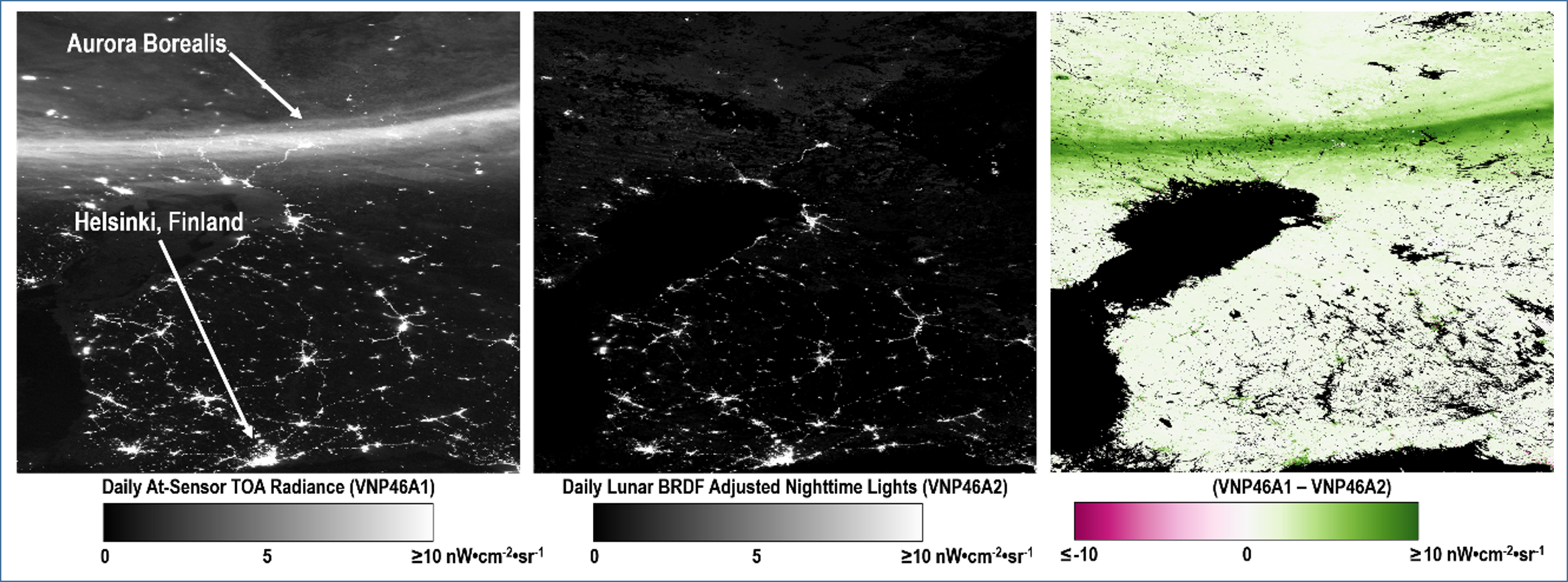
The VNP46A2 Daily Moonlight-adjusted Nighttime Lights (NTL) Product
Both VNP46 products use the standard suite of VIIRS land products as input and are integrated as part of NASA's Black Marble processing chain which contains both daytime and nighttime branches. For the daytime branch, a modified version of the operational VIIRS surface reflectance algorithm (Roger et al., 2016; Vermote et al., 2014) is used to generate the DNB surface bidirectional reflectance factor (BRF) using NASA's Level 1B calibrated radiance product as input (i.e., 6-minute granules, or 2366km along track and ~3100km across-track). Level 2G DNB surface reflectance is then generated by performing spatial and temporal aggregation to 15 arc second grid cells over daily time periods (Campagnolo et al., 2016; Pahlevan et al., 2017; Wolfe et al., 1998; Yang and Wolfe, 2001). Daily Level 3 DNB BRDF/Albedo data are then retrieved using the heritage MODIS/VIIRS algorithm (MCD43/VNP43) (Liu et al., 2017, Liu et al., 2017; Wang et al., 2018), and corresponding snow flags are estimated using the VIIRS Normalized Difference Snow Index (NDSI) algorithm (VNP10) (Riggs et al., 2016, Riggs et al., 2017). The NDVI and NDSI values are used to determine the growing, dormant, and snow periods to routinely update the a priori global database of the DNB BRDF product (Cescatti et al., 2012; Liu et al., 2017, Liu et al., 2017; Román et al., 2009). Surface bidirectional reflectance factor from the VIIRS I1 (red) and I2 (NIR) channels is used to obtain daily estimates of LAI (Knyazikhin et al., 1999; Park et al., 2017; Xiao et al., 2016). The retrieved leaf area index and clumping index values are then used to calculate the gap fraction probability (Pgap).
| Input File | Description |
|---|---|
| VNP46A1 | VIIRS/NPP Daily Gridded Day Night Band 15 arc second Linear Lat Lon Grid Night |
| VNP43LGDNBA1 | VIIRS/NPP DNB BRDF/Albedo Model Parameters Daily L3 Global 15 arc second LLL Grid |
| VNPPLG09GA | VIIRS/NPP Surface Reflectance Daily L2G Global 1km and 15 arc second Linear Lat Lon Grid |
| VNP04LGA | VIIRS/NPP Aerosols Optical Thickness Daily L2G Global Linear Lat Lon Grid |
The daily moonlight and atmosphere corrected NTL (VNP46A2) is available at 15 arc second resolution starting from January 2012. The VNP46A2 product has 6 layers containing information on BRDF-corrected NTL (15 arc second), lunar irradiance, mandatory quality flag, latest high-quality retrieval (number of days), snow flag, and cloud mask flag. The table below details the information within the product layers.
| Scientific Datasets (SDS HDF Layers) |
Units | Description | Bit Types | Fill Value | Valid Range | Scale Factor | Offset |
|---|---|---|---|---|---|---|---|
| DNB_BRDF-Corrected_NTL | nWatts cm-2 sr-1 | BRDF corrected DNB NTL | 16-bit unsigned integer | 65535 | 0 - 65534 | 0.1 | 0.0 |
| Gap_Filled_DNB_BRDFCorrected_NTL | nWatts cm-2 sr-1 | Gap Filled BRDF corrected DNB NTL | 16-bit unsigned integer | 65535 | 0 - 65534 | 0.1 | 0.0 |
| DNB_Lunar_Irradiance | nWatts cm-2 sr-1 | DNB Lunar Irradiance | 16-bit unsigned integer | 65535 | 0 - 65535 | 0.1 | 0.0 |
| Mandatory_Quality_Flag | Unitless | Mandatory quality flag | 8-bit unsigned integer | 255 | 0 - 3 | N/A | N/A |
| Latest_High_Quality_Retrieval | Number of days | Latest high quality BRDF corrected DNB radiance retrieval | 8-bit unsigned integer | 255 | 0 - 254 | 1.0 | 0,0 |
| Snow_Flag | Unitless | Flag for snow cover | 8-bit unsigned integer | 255 | 0 - 1 | N/A | N/A |
| QF_Cloud_Mask | Unitless | Quality flag for cloud mask | 16-bit unsigned integer | 65535 | 0 - 65534 | N/A | N/A |
